Image 1 of 3
 Image 2 of 3
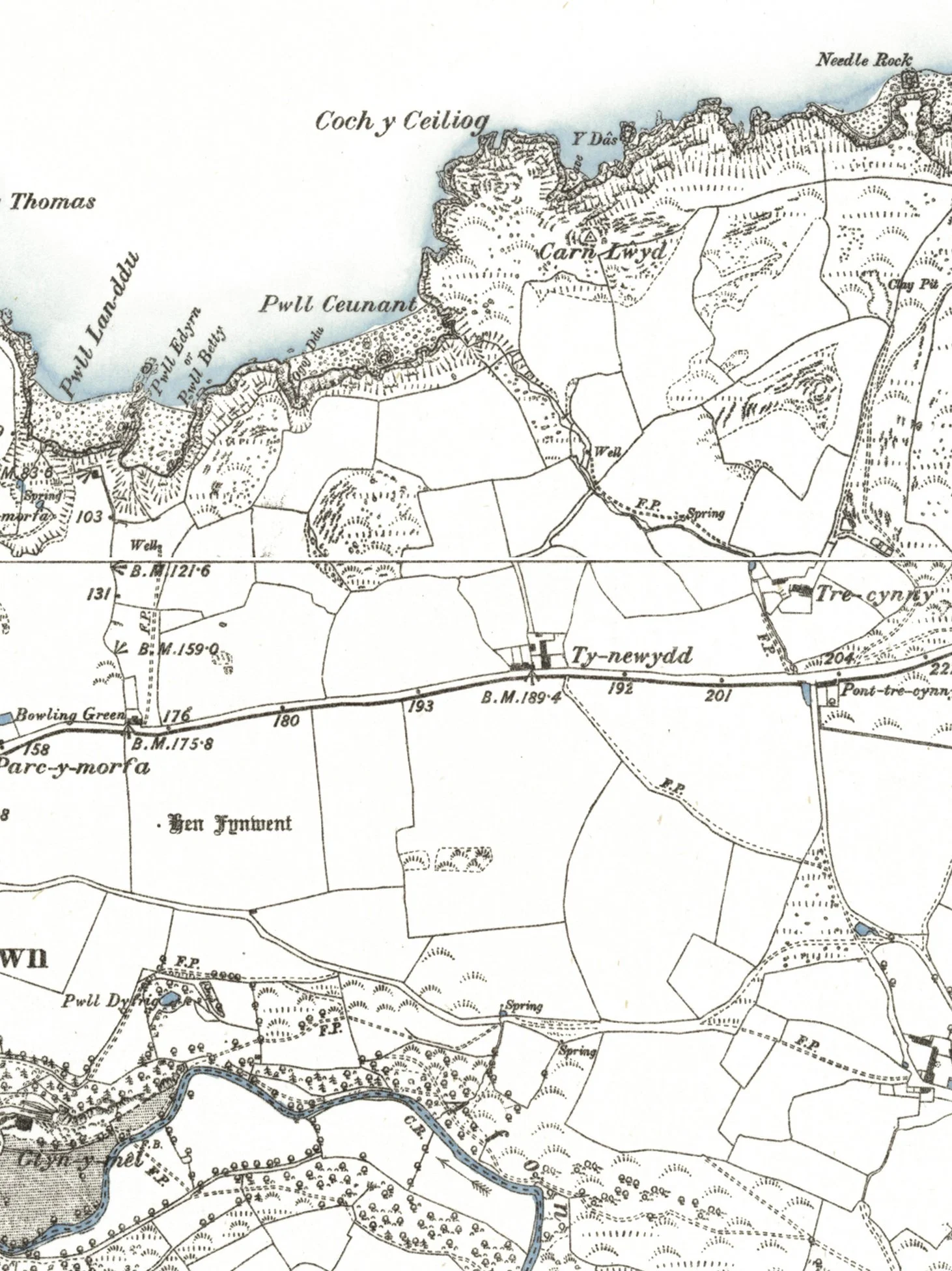 Image 3 of 3
A print created from circa 1888 maps. This large map covers Fishguard Bay and includes Dinas Head, Lower Town, Fishguard and Goodwick on the north Pembrokeshire coast. It’s carefully stitched together by Jon from a series of antique six inch to the mile OS maps, is incredibly detailed and adorned with traditional Welsh names for all the promontories, inlets, rocks, hills and more...
This map also predates any of the harbour workings in Goodwick, and includes references to names now buiried under the harbour, such as Ogof Mrs. Luke, Ogof Gwellt, and Wig Wen amongst others.
The third image shows the level of detail shown in approximately a 15cm area of the map.
It is available as a fine art giclée print on archival quality Hanemuhle Photorag heavyweight paper, or on 180gsm lustre paper - please select from the options above.
Please note - the price is for either a fine art print or a lustre quality print of the map, the frame is not included.